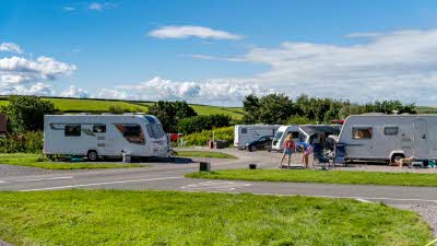
Book a Club campsite
Explore hundreds of Club Sites and plan for stays throughout the year. There are plenty of locations to choose from, search and book today.
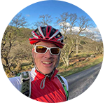
Book nowJonathan Manning revels in unbeatable Scottish mountain scenery on a route accessible to riders of all fitness levels
This magnificent Highlands route must surely offer the most spectacular views for the smallest amount of effort of any ride in the country.
Starting and finishing at Maragowan Killin Club Campsite, it follows the River Lochay up Glen Lochay on velvet-smooth asphalt, with the drama of the surrounding mountains building at every turn of the pedals. Several of the summits you can see here are higher than anywhere in England, the gnarled, rocky ridgeline leading along both sides of the valley.
As an out-and-back route, there’s almost no navigation to think about, leaving you free to admire the panorama that includes two Munros (peaks more than 3,000 feet above sea level) – Creag Mhòr and Beinn Heasgarnich.
Look out for golden and sea eagles, as well as a full roster of other birds of prey, waders, ptarmigan and grouse. There are also red deer, otter, pine marten, and hare in the glen, which is part of a project that aims to achieve biodiversity with minimum human intervention. The project began with the planting of more than 800,000 trees to re-establish 522 hectares of woodland, an area equivalent to 700 football pitches.
Close to the start of the ride the National Trust for Scotland maintains an old longhouse, where Gaelic-speaking farmers used to live alongside their animals. Moirlanich Longhouse is open on Wednesday and Sunday afternoons between May and September.
The gradient is modest throughout the ride, barring one short climb up from the river, and the return leg is gently downhill all the way. It is, however, a ride to save for better weather, with no shelter from wind or rain.

1. From Maragowan Killin Club Campsite turn right along the A827, and in 450m turn left, signposted to Moirlanich Longhouse. Continue on this road, crossing the river after about 3km, and keep heading up the valley for a further 9km until the asphalt gives way to rough gravel.
2. 12.9km – Turn around and retrace your route (keener and experienced mountain and gravel bikers can keep going on the tracks if they wish). Continue for 9km to reach an electricity station on the right.
3. 22km – Keep straight ahead at the electricity station (do not descend to the right to cross the river) and continue for 2.5km to reach a T-junction with the A827.
4. 24.6km – Turn right at the junction. Maragowan Killin Club Campsite is on the left in about 700m.
You can download this route from our dedicated Strava page here.