Wonder walls
Mark Sutcliffe embarks on a fascinating tour around York’s ancient city walls direct from York Rowntree Park Club Campsite
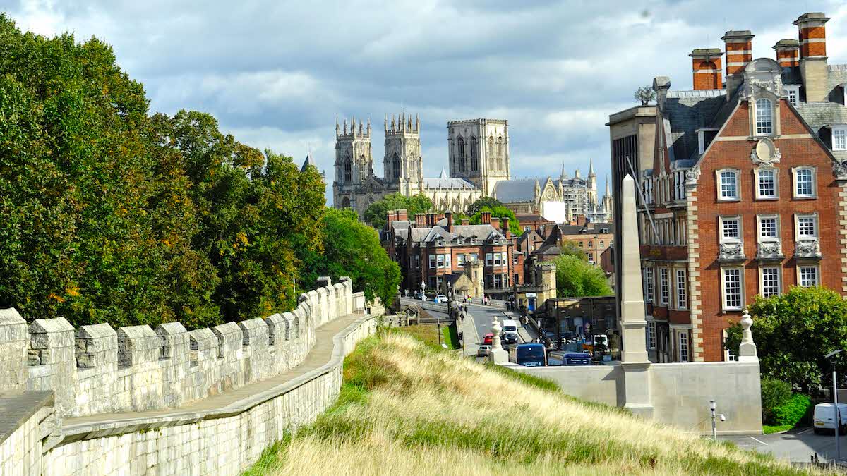
York’s city walls are the longest of their type in England and provide an amazing way to explore the sights and enjoy spectacular vistas away from the noise of the traffic.
This easy four-mile circular route takes in the most extensive sections of the walls, which were originally built in 71AD, along with a lovely stretch of the river on a largely traffic-free tour of the city’s historic highlights – including York Minster, Museum Gardens, the Shambles and the contemporary Millennium Bridge.
The route should take around two hours to complete but allow plenty of extra time for fascinating detours along the way. Build in an hour or so for lunch at one of the city’s many cafés and restaurants and this urban adventure will easily occupy an entire day.
Dogs are not allowed on the walls, so ensure you have appropriate doggy daycare in place.
Directions
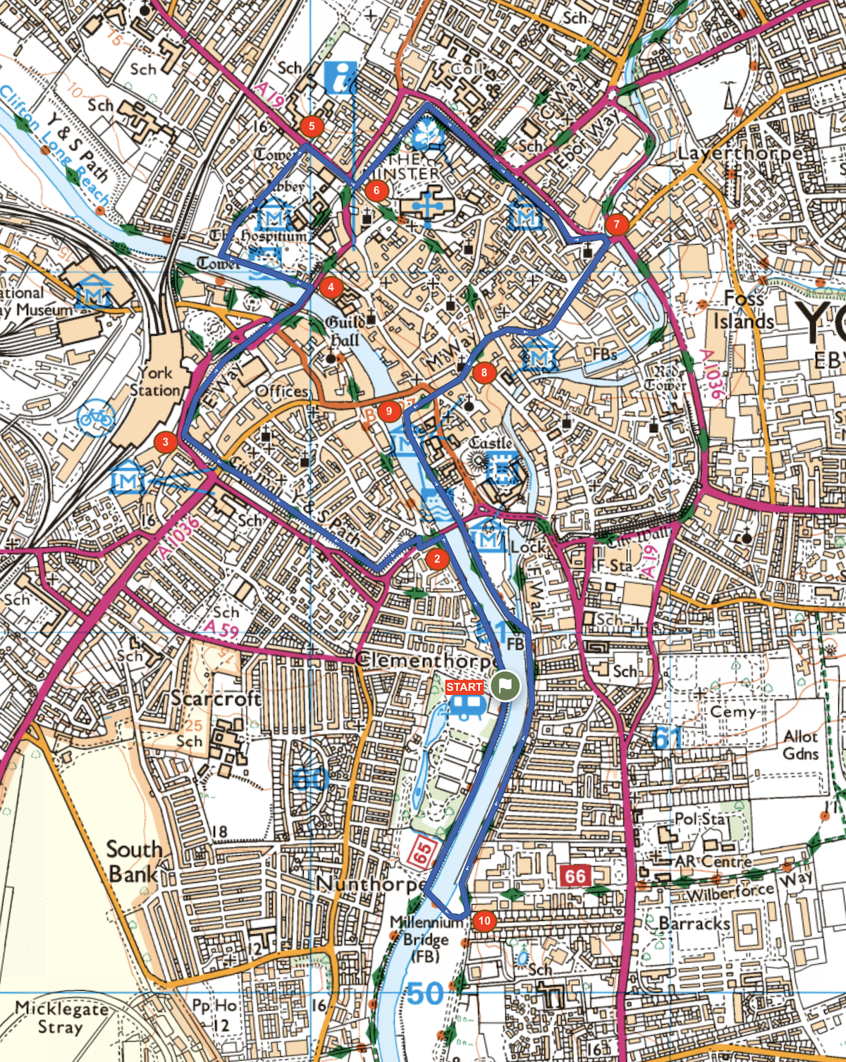
1. From the main gate of York Rowntree Park Club Campsite, turn left and head upstream along the River Ouse towards Skeldergate Bridge.
2. 0.5km – At the bridge, head left up a ramp and cross Bishopgate Street with care, then head left up the steps on to the walls. Follow the walls northwest to Micklegate and continue to a sharp corner adjacent to the railway station.
3. 1.4km – Continue past the station and grand hotel towards York Minster. Descend to street level and continue past Barker Tower and over Lendal Bridge then descend left on to Dame Judi Dench Walk on the riverside footpath.
4. 2.0km – Continue along the riverside to an archway, then head right through the floodgates on to a footpath alongside the walls. Continue past York Museum Gardens and the Minster Inn, then turn right onto Bootham.
5. 2.6km – Head towards York Minster and at the junction, veer right through an archway then cross the road at the pedestrian crossing and, at the tower, climb the steps up on to the walls.
6. 2.7km – Follow the wall as it heads right around York Minster and at Monk Bar, descend to street level, cross a road and rejoin the walls on the far side. Continue on the walls for another 400m then descend left on a ramp to ground level and continue through a gate.
7. 3.8km – Turn sharp right at the junction and walk along Peasholme Green, following the pavement as it curves gently right then back left, passing the Shambles.
8. 4.2km – At a crossroads beside All Saint’s Church veer left along Coppergate, straight across Clifford Street and down the cobbled street to the river.
9. 4.5km – At the river, head left and continue underneath Skeldergate Bridge and along the embankment, crossing the confluence with the River Foss and continuing downstream on the embankment to Millennium Bridge.
10. 6.1km – Cross the bridge and head right (upstream) for 750m to reach the Club Campsite.
About the route
- Start/finish: York Rowntree Park Club Campsite, Terry Avenue, York YO23 1JQ.
- Distance: 4.3 miles/ 7km.
- Time: 2 hrs 15 mins.
- Level: Suitable for occasional walkers with a reasonable level of fitness.
- Terrain: Level waterside paths with some steep steps up and down from walls. Total ascent: 40 metres.
- Landscape: Riverside footpaths, city centre streets, elevated city walls.
- Refreshments: Huge choice of cafés and restaurants in the city centre. The Star Inn adjacent to Lendal Bridge is a nice spot.
OS Maps
Club members save 25% on an OS Maps annual subscription, which gives you access to intuitive route planning tools and real-time GPS navigation while offering downloadable maps and offline access. Find out more at camc.com/ordnancesurvey
The Caravan and Motorhome Club make no warranties concerning the accuracy or completeness of the routes published, which to the best of our knowledge were correct at the time of publication. Your use of the routes is at your own risk and we accept no responsibility for the suitability or safety of any routes published. Routes may be out of date or affected by changes to the physical environment and, to the extent permitted by law, we accept no responsibility for personal injury or property damage caused by your use of the routes.
About the author