Appointment to view
Mark Sutcliffe enjoys the stunning scenery of the Lake District without working up a sweat
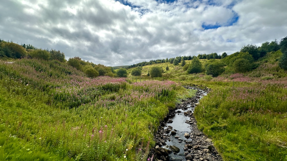
This easy and rewarding short walk among the foothills of the spectacular northern fells of the Lake District delivers wonderful views of the peaks all around the magical Troutbeck Head Club Campsite without too much climbing.The route skirts the northern edge of the secluded valley of Matterdale: home of the farmer and writer James Rebanks, who continues to farm this rugged, rolling countryside high above the banks of Ullswater. It’s a lovely walk to do in late summer, when the brilliant orange of the rowan berries clashes riotously with the smoky purple of the heather to paint the hillsides in a vivid, almost tropical palette.As you climb to the highest point on Cockley Moor you get magnificent views of some of the very highest mountains in England: Helvellyn, Blencathra and Skiddaw.
The first part of the walk does involve a section of road walking, but this stretch isn’t too busy outside of peak hours, so take care and you will soon be on quiet footpaths.
Directions
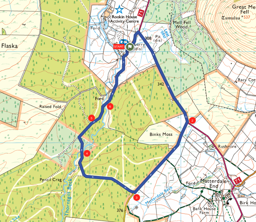
1. From the main gate of the Club campsite, head down the access drive and at the road turn right, climbing steadily up a hill towards the woods.
2. 1.4km – As the road starts to head downhill, at the finger post, take the quiet lane on the right. Follow this lane for a mile and a half, skirting woods and mossland of Matterdale Forest.
3. 2.3km – After half a mile, take a track on the right into some woods. Follow the track as it descends through the woods to the beck. Up to the left, above the trees you can see the pronounced ‘saddle’ that gives Blencathra its alternative name of Saddleback.
4. 3.2km – Cross the beck and climb the other side. After 250m, at the junction, turn right.
5. 3.6km – At the next junction, continue straight ahead and remain on a gravel track as it becomes a surface road.
6. 3.8km – Recross the beck, go through a metal gate and the back gate to the Club campsite is 25m on the left.
Download this route and others to your smartphone or GPS device from the Club’s OutdoorActive page at: out.ac/IPp3bt
About the route
- Start/finish: Troutbeck Head Club Campsite, Troutbeck, Penrith CA11 0SS
- Distance: 4.6km/2.9 miles.
- Time: 1 hr 45min.
- Level: Suitable for occasional walkers with a reasonable level of fitness.
- Terrain: Country lanes and forest tracks.
- Landscape: Undulating with gradual climbs and descents.
- Refreshments: None.
OS Maps Member offer
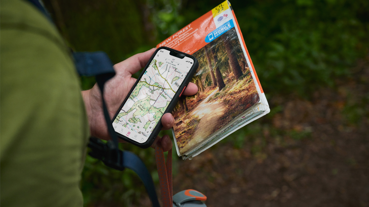
Club members save 25% on an OS Maps annual subscription which gives you access to intuitive route-planning tools and real-time GPS navigation while offering downloadable maps and offline access. Find out more at camc.com/ordnancesurvey.
The Caravan and Motorhome Club make no warranties concerning the accuracy or completeness of the routes published, which to the best of our knowledge were correct at the time of publication. Your use of the routes is at your own risk and we accept no responsibility for the suitability or safety of any routes published. Routes may be out of date or affected by changes to the physical environment and, to the extent permitted by law, we accept no responsibility for personal injury or property damage caused by your use of the routes.
About the author