Save up to 50% on great days out
Members get great savings at attractions throughout the UK and Ireland with our Great Savings Guide.
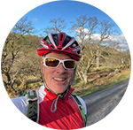
FIND OUT MOREJonathan Manning expounds the virtues of A Wainwright’s legendary walking guidebooks

Happy with the familiar – or seeking fresh horizons? For every Club member who has a favourite pitch on a favourite site and always goes on a favourite walk, there’s another on a constant quest for new adventures.
For these restless souls (soles?) there are plenty of options – whether you want to ‘bag’ Scotland’s 282 Munros (mountains taller than 3,000 feet), summit the 222 Corbetts (Scottish mountains between 2,500 and 3,000 feet high, with at least 500 feet of descent on all sides) or scale the 1,542 Marilyns (hills of England, Scotland, and Wales that are at least 150m higher than the surrounding land), there is an altitude-infused ‘tick list’ available.
Such challenges can involve days of planning and countless miles of driving. But what if there were a walking tick list containing 214 classic entries, tightly packed enough to avoid the need for cross-country driving odysseys? Of course, there is – the Wainwrights, the hills and mountains documented in Alfred Wainwright’s seven-volume Pictorial Guide to the Lakeland Fells.
Each guidebook is more like a love letter to the Lake District; Wainwright wrote poetically and sketched beautifully as he celebrated the fells. Famously flat-capped and curmudgeonly, the treasurer of Kendal Town Hall never intended to create a tick list. He said his books were simply “one man’s way of expressing his devotion to Lakeland’s friendly hills... after many years of inarticulate worshipping at their shrines”.
Wainwright’s eureka moment occurred when he visited the Lake District in 1930 for the first time. Walking from Windermere train station he headed up the nearest hill, Orrest Head, from where the view “cast a spell that changed my life”.
The path to the top – 784ft – has undoubtedly improved since then and there’s a wheelchair accessible trail. The summit benches and topograph that details every peak on the horizon reflect the popularity that Wainwright’s endorsement has bestowed on this spot, but the breathtaking panorama of more than 25 fells remains the same as on his original visit, stretching from Coniston Old Man in the south, via Scafell Pike and Great Gable, to Fairfield and Red Screes in the north, with Windermere in the foreground.
“It was a moment of magic, a revelation so unexpected that I stood transfixed, unable to believe my eyes. I saw mountain ranges, one after another, the nearer starkly etched, those beyond fading into the blue distance. Rich woodlands, emerald pastures and the shimmering waters of the lake below added to a pageant of loveliness,” Wainwright wrote later.
Almost a century on, the view packs the same punch, the hilltop rewarding the effort of a 30-minute climb a hundred times over, from the pathside prettiness of its daffodils, bluebells and foxgloves to the excitement of seeing a red squirrel scuttle up a giant oak tree.
Yet while Orrest Head feels like an appropriate tick-off starting point, it isn’t actually a ‘Wainwright’. The guide writer set an entry criterion that summits had to be more than 1,000ft above sea level (171 of them rise above 2,000ft), and broke his rule only once to include 951ft Castle Crag in Borrowdale, which was “so magnificently independent, so ruggedly individual, so aggressively unashamed of its lack of inches,” that it deserved the full fell treatment in the Pictorial Guide.

The guidebooks divide the Lake District into seven geographical areas, which makes it easier to ‘complete’ one book before progressing to the next. Troutbeck Head Club Campsite is an ideal basecamp for ticking off summits in Books One and Five; Meathop Fell or Kendal Club campsites for Book Two; Borrowdale Club Campsite for Book Three; and Coniston Park Coppice for Book Four.
For years I have treated the Pictorial Guide volumes like diaries, noting the date when I climbed each fell, who I was with, and any other notable memories, although it’s impossible to surpass Wainwright’s neat, hand-written descriptions and the forensic detail of his sketches.
With astute planning and reasonable fitness it’s possible to tick off two, three or four fells in a single walk, although to race to complete a circuit of all 214 peaks would be contrary to the spirit of Wainwright’s desire to savour each summit – it took him 13 years to walk and produce his books.
Nor is the point of a tick list simply to cherry pick the finest walks, although Wainwright did name his six best fells as Scafell Pike, Bowfell, Pillar, Great Gable, Blencathra and Crinkle Crags, all of which had, “the attributes of mountains, ie height, a commanding appearance, a good view, steepness and ruggedness”. However, he also wrote, “For beauty, variety and interesting detail, for sheer fascination and unique individuality, the summit area of Haystacks is supreme”, requesting that his ashes should be scattered by the side of Innominate Tarn close to the top.
“And if you, dear reader, should get a bit of grit in your boot as you are crossing Haystacks in the years to come, please treat it with respect. It might be me,” he wrote in Memoirs of a Fellwalker.
It’s a line that sticks with me as I revisit Haystacks with my son on a humdinger of a blue-sky day, when the tarn mirrors the candyfloss clouds and gnarled fells beyond. It feels like an appropriate place to finish.

Two more hillwalking tick lists to consider
Bag the munros
Reach the tops of all 282 mountains in Scotland taller than 3,000ft using a tick list named after Sir Hugh Munro. Most are accessible to hill walkers, but you’ll need mountaineering skills to complete them all.
Info: walkhighlands.co.uk
Master the Marilyns
A total of 1,542 hills with a drop of 150 metres (nearly 500 ft) or more on all sides make up the Marilyns of England, Scotland and Wales. Anyone who has climbed 600 British Marilyns or more is eligible for entry into the ‘Marilyn Hall of Fame’.
Info: rhsoc.uk
A few things to consider before setting off on a walk